The story
from WikipediaRead it all ↗Prior to American settlement, Camano Island was within the territory of both the Kikiallus and the Snohomish peoples. The Kikiallus controlled the northern parts of the island around modern-day Utsalady, while the Snohomish controlled the areas of the island south of Point Demock (Lushootseed: duʔdukʷšəd). Other tribes also used the island, such as the Lower Skagit, Stillaguamish, Snoqualmie, and Sauk-Suiattle. The island may have been a "free-use" area where usage was not strictly restricted like other places.
Text from Wikipedia, licensed CC BY-SA 4.0.
Timeline
built from the dates on the items belowStart Camano’s collection
The first neighbors to add old photos shape how Camano’s history is told.
1 of 10 decades since 1900 have photos 🔁Retake an old viewThe Town Crier, v.10, no.1, Jan. …, 1915: stand where they stood+15 📦Share a family photoSign in to add one+10Famous people close to Camano
See all 17 →



Camano, decade by decade
1990s
4 historic places in Camano
Camano has 4 listings on the National Register, and they protect 53 historic buildings, because Cama Beach Resort alone counts 50.
Where they are
Architectural styles
When they were listed
 Listed 1993Montague and McHugh Building
 Listed 1998Utsalady Ladies Aid Building
 Listed 2001Cama Beach Resort
 Listed 2012Kristoferson Dairy
Then & now
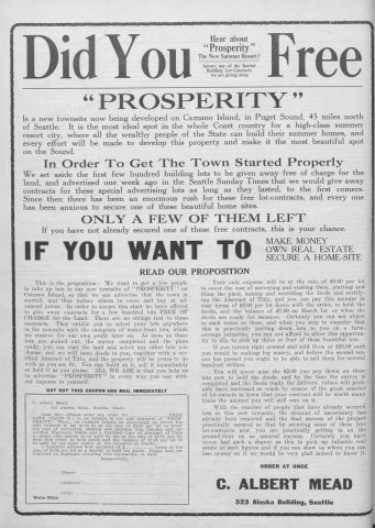
No then-and-now pairs yet. Take a photo from the same spot as The Town Crier, v.10, no.1, Jan. 2, 1915 (1915) and it appears here side by side.
🔁 Retake this view · +15Stories next door
nearby towns’ historyFrom Wikimedia Commons (6). Images are copied here with their credits and licenses, shown on each photo’s page. Refreshed monthly.