Los Indios

What’s happening
Weather
Forecast →Upcoming events
Put the next local happening — a market, a meeting, a concert — on the map.
Local news
Loading local headlines…
Headlines via Google News · Articles belong to their publishers.
The Los Indios album
Outdoors in Los Indios
Parks & trails →Know a trail or park that’s missing? Anyone can add it to OpenStreetMap, and it shows up here on the next refresh.
Trails & parks © OpenStreetMap contributors · Conserved land: USGS PAD-US
About Los Indios
Town in Texas, United StatesLos Indios is a U.S. border town in Cameron County, Texas. The population was 1,008 at the 2020 census. It is included as part of the Brownsville–Harlingen–Raymondville and the Matamoros–Brownsville metropolitan areas. The Free Trade International Bridge connects Los Indios with Matamoros, Tamaulipas.
From Wikipedia, licensed CC BY-SA 4.0 · facts via Wikidata (CC0)
Town numbers
Housing in Los Indios
The median sale price was $152,000 in March 2026.
Work & commute in Los Indios
Full picture →Most working residents leave Los Indios for work: only 0% work in town. The top destinations are Harlingen (25%), Brownsville (16%) and San Benito (7%). Half commute less than 17 miles.
Health in Los Indios
Compared with Texas
of 26 measures CDC estimates. The other 12 are too close to call.
What stands out
Care nearby
Natural hazards in Los Indios
Expected storm and flood damage is higher than in 70% of U.S. communities.
Climate in Los Indios
Full climate →Los Indios has warm winters and hot summers. A typical July afternoon reaches 96°, a January night drops to 51°, and snow is almost unheard of.
Libraries near Los Indios
See all →Where Los Indios is
Explore map →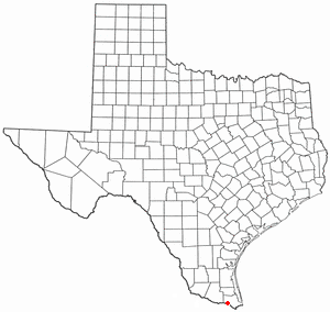

Location map