Sign inJoin

BoulderUT

A town of 360, settled in 1890. Nearly 66.2% of it is conserved land.

Population
360
residents
Household income
$40K
median
Median age
42.4
years
Jobs based here
104
Balanced

What makes Boulder stand out

The thing Boulder does most differently from other towns.

Picked automatically from the data
Small town

360 people, and everyone knows the way

In a town this size, neighbors are the best guide. Ask them anything.

Nearby towns

Boulder’s report card

See the data ↓

Now in Boulder

Be the first to start the conversation.

Be the first neighbor to joinJoin Boulder →
Residents weigh in
Live in Boulder? Is a B− for its schools right?
Your answer becomes a post in Boulder’s Town Square.
Start a conversation
64°
Chance Showers And Thunderstorms
H 62° · L 51°

Local news

All →

Upcoming events

Nothing on the calendar.

The data

Ordered by what stands out in Boulder. Another town gets a different order.

Outdoors

Nearly a third of Boulder is conserved land

19 miles of trails across 3 parks and preserves.

66.2%conserved
66.2%
conserved · 8,813 of 13,315 acres
19 mi
of trails · 0.9 per sq mi
Biggest places to walkTrailsAcres
1. Boulder Town Park0.3 mi8
2. North Escalante Canyons/The Gulch Instant Study Area—158
3. Anasazi State Park—6
Trails & parks © OpenStreetMap contributors · Conserved land: USGS PAD-USParks & trails →
Natural hazards

Very low risk, with inland flooding at the top

Expected storm and flood damage is higher than in 18% of U.S. communities.

18risk score of 100
FEMA risk score
18Very low riskLowerHigher
Inland floodingHeat wavesAvalanches
FEMA National Risk Index · OpenFEMANatural hazards →
Climate

Snowy winters, pleasant summers

Boulder has chilly, snowy winters and pleasant summers, with very little rain. A typical July afternoon reaches 84°, a January night drops to 20°, and about 52 inches of snow falls in a normal winter.

52″snow a winter

Typical low → high °F

Winter20–40°
Spring34–59°
Summer55–81°
Fall38–61°
Oct 14
typical first frost
May 4
typical last frost
+1.9°
vs. the 20th-century average
NOAA U.S. Climate Normals, 1991–2020Full climate →
Work & commute

Most working residents commute out of Boulder

Most working residents leave Boulder for work: only 2% work in town. The top destinations are Bryce Canyon City (18%), Escalante (9%) and Tropic (8%). Half commute less than 44 miles.

2%work in town

Where working residents work

In Boulder2%
Bryce Canyon City18%
Escalante9%
Tropic8%
Panguitch5%
44 mi
median commute distance
104
jobs based in Boulder
Balanced
jobs vs. working residents
Census LEHD 2023 · ACSCommute map →
Health

How healthy Boulder is

Boulder beats the Utah average on 4 of 32 CDC measures and trails it on 10.

32 measures vs. Utah
4 better18 too close to call10 worse
What stands outBoulderUT
Fewer binge drinkers10.1%12.4%
More adults treating high blood pressure75.5%65.6%
More adults with heart disease7.9%4.7%
Intermountain Health Garfield Memorial Hospital
54.7 mi away · emergency room
3 of 3
care shortages: primary care, dental, mental health
CDC PLACES 2025 · modeled estimates for adults · CMS · HRSAFull health report →
Schools

Boulder’s public schools outperform 48% of Utah districts

The public schools Boulder’s kids attend trail 52% of Utah’s districts on state tests. Among towns with similar incomes, they rank near the bottom.

B−School Grade
SchoolGradesStudentsGrade
Boulder SchoolPK–67Not graded
NCES · EDFacts · graded within UT on state testsAll 1 schools →
Get outside

19 miles of trails in Boulder

66.2% of the town is conserved land, across 3 parks and preserves.

Map of trails and conserved land in BoulderConservedTrails
1
Boulder Town Park0.3 mi of trails · 8 acres
Directions
2
North Escalante Canyons/The Gulch Instant Study Area158 acres
3
Anasazi State Park6 acres
Directions
Trails © OpenStreetMap contributors · USGS PAD-US
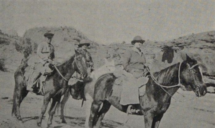
Garfield Stake Relief Society officers (Relief Society Magazine, 1925)
1925 · Garfield Stake Relief Society officers (Relief Society Magazine, 1925) · Wikimedia Commons
Boulder’s story

136 years in pictures

6 postcards, papers and photographs from public archives, and 2 places on the National Register.

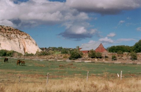
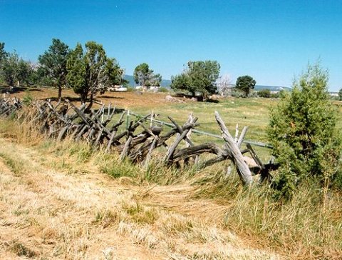
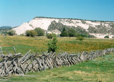
Scenic Byway 12 - Horses Grazing inScenic Byway 12 - Old Pioneer Fence inScenic Byway 12 - Old, Pioneer-Era Fence in
Explore the history →

About Boulder

Town in the state of Utah, United States

Official town website ↗

Boulder is a town in Garfield County, Utah, United States, 27 miles (44 km) northeast of Escalante on Utah Scenic Byway 12 at its intersection with the Burr Trail. As of the 2020 census, the town population was 227. Boulder was isolated from other communities until the Civilian Conservation Corps built a road from Escalante, and did not get electric power until 1947. The town marks the western terminus of Burr Trail, a mostly paved road that runs eastward through red rock country to the Waterpocket Fold in Capitol Reef National Park. Boulder is the home of Anasazi Indian State Park.

From Wikipedia, licensed CC BY-SA 4.0 · facts via Wikidata (CC0)

Established
1890
Population
227
Area
21 sq mi
Elevation
6,703 ft
ZIP code
84716
Area code
435

More about Boulder

Still missing for Boulder:a photo of Boulderupcoming events

Post to Boulder

We’ll email a one-tap link to publish your post. No password, and nothing is public until you click it.
Already a member? Sign in