The story
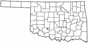
from WikipediaRead it all ↗Elgin developed as the Oklahoma City and Western Railroad (OCWR) (later absorbed by the St. Louis–San Francisco Railway) constructed a line from Chickasha, Oklahoma to Lawton, Oklahoma between 1901 and 1903. A post office was established in April 1902 and named "Ceegee", derived from Charles G. Jones, president of the OCWR and developer of the town. The railroad management objected to this name and demanded that it be changed. This was done in July 1902.
Text from Wikipedia, licensed CC BY-SA 4.0.
Start Elgin’s collection
The first neighbors to add old photos shape how Elgin’s history is told.
0 of 10 decades since 1900 have photos 📦Share a family photoSign in to add one+10Elgin, decade by decade
2000
Then & now
When neighbors add old photos, retakes from the same spot appear here side by side.
Stories next door
nearby towns’ historyFrom Wikimedia Commons (1). Images are copied here with their credits and licenses, shown on each photo’s page. Refreshed monthly.