History · Cameron

Cameron’s history is
mostly unwritten

The public archives hold no old photos of Cameron. The rest are in attics, shoeboxes and the historical society. Help start the collection.

0old images & papers
1historic places
4recent photos

The story

from WikipediaRead it all ↗

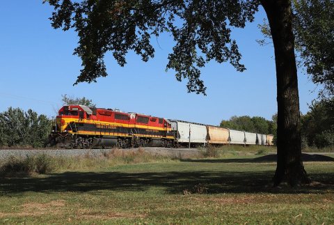
When the Fort Smith and Southern Railway laid tracks in the area of the present day town of Cameron in 1886–87, there was already a settlement of about 40 people. At the time of its founding, Cameron was located in Skullyville County, a part of the Moshulatubbee District of the Choctaw Nation. The U. S. Post Office Department established a post office that it named Cameron, Indian Territory in 1888.

According to Encyclopedia of Oklahoma History and Culture, the post office and town may have been named for either of two persons. One was William Cameron, a former Mine Inspector for Indian Territory. The other was James Cameron, an employee of the Fort Smith and Southern Railway.

Text from Wikipedia, licensed CC BY-SA 4.0.

Be one of the first

Start Cameron’s collection

The first neighbors to add old photos shape how Cameron’s history is told.

0 of 10 decades since 1900 have photos 📦Share a family photoSign in to add one+10
Famous people from CameronWriters, athletes, leaders and more who were born in Cameron.Meet them →
By decade

Cameron, decade by decade

Before
2000
No old photos in the archives yetWeddings on Main Street, storms, parades, school pictures, the old store. If it’s in your family album, it belongs here.
📷 Add from your album
National Register of Historic Places

1 historic place in Cameron

1 place in Cameron is on the National Register of Historic Places, the country’s official list of buildings and places worth saving.

#136
In Oklahomaby listings · most towns there have none
1place listed1 building
0National Historic LandmarksNone here yet
1historic building protectedcounting each building in a district
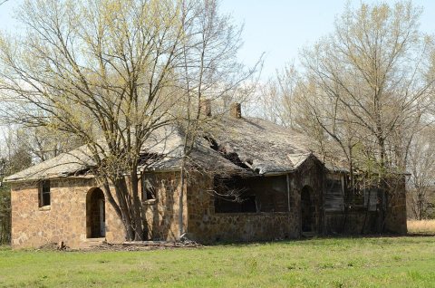
1977first listedJames E. Reynolds House

Where they are

Tap a dot for a photo and link. Districts show at their center.
Buildings

When they were listed

The Register began in 1966.
National Park Service, National Register of Historic Places (05/22/2026) · styles from the National Archives catalog · photos from Wikimedia Commons, credited on each place

Then & now

When neighbors add old photos, retakes from the same spot appear here side by side.

Stories next door

nearby towns’ history

From Wikimedia Commons (4). Images are copied here with their credits and licenses, shown on each photo’s page. Refreshed monthly.

The coffee’s on

Where to, neighbor?

You’re in Cameron, OKView boundary

Nearby

All towns & citiesExplore the map
Loading boundary…

Cameron is your selected town. The feed includes posts assigned to this town, not a distance radius or ZIP code.

Neighborhoods narrow the feed further, while townwide announcements, events, and issues remain visible.

Boundary source: https://tigerweb.geo.census.gov/arcgis/rest/services/TIGERweb/Places_CouSub_ConCity_SubMCD/MapServer/18 · 2025-01-01