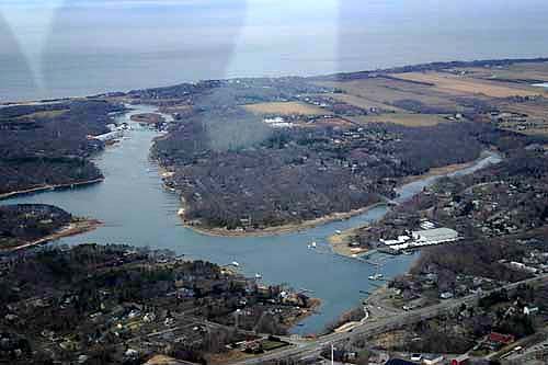
About 6.1% of Mattituck is conserved land, roughly 473 acres. There are about 5.8 miles of mapped trails, and the biggest networks are in Mill Road Preserve (1.1 mi).
Conserved land
6.1%
473 of 7,700 acres
Trails
5.8 mi
0.5 mi per sq mi · 4 on conserved land
Parks & preserves
11
103 conserved acres per 1,000 people
Bike routes
0.0 mi
Highest peak
148 ft
Mattituck Hills
Lakes & rivers
7
8 beaches · 4 boat launches
What kind of outdoors town is Mattituck?
Read from the map. The page puts what stands out first.
Who manages Mattituck’s conserved land, from the USGS Protected Areas Database. Approximate, because parcels can overlap.
USDA easements (NRCS)104 ac
State parks95 ac
Regional Water Districts92 ac
Town or city77 ac
State conservation48 ac
County46 ac
Regional agency38 ac
Local Park · 156 acAgricultural Easement · 104 acLocal Other or Unknown · 96 acState Conservation Area · 54 acConservation Easement · 36 ac
Good to know
Conserved doesn’t always mean open to visitors. 141 acres are conservation easements, usually private land. Public access isn’t recorded for 5 of 17 parcels. The walks above are places people visit.
The biggest protected places
Place
Managed by
Acres
Public access
Suff Cty Water Authority Land
Local Other or Unknown
Regional Water Districts
92
Unknown
Town of Southold Land
Local Park
Town or city
50
Unknown
Suffolk County Land
Local Park
County
42
Unknown
Mattituck Park District Lands
Local Park
Regional agency
37
Open
Oregon Marsh State Tidal Wetland
State Conservation Area
State conservation
31
Open
Bailie Beach District Park
Local Park
Town or city
25
Open
Hallock State Park Preserve
State Conservation Area
State parks
23
Open
Mattituck Creek Waterway Access Site
State Recreation Area
State conservation
17
Open
Peconic Land Trust Lands
Private Other or Unknown
Land trusts & nonprofits
14
Closed
Suffolk County Lands
Local Other or Unknown
County
4
Unknown
2 smaller protected places aren’t shown.
Biking & sports
0.0 miles of bike routes
Bike lanes are often missing from the map in smaller towns, so that number is likely low.
0.0 mi
painted or protected bike lanes
0.0 mi
off-road bike paths
0.0 mi
shoulders & shared lanes
Courts & fields
9Tennis
5Baseball
2Pickleball
1Soccer
1Beach volleyball
Includes school and college facilities, which aren’t always open to the public.
History along the way
2 historic sites to visit
Plus 2 cemeteries, often the oldest places in town.
"Trails" are OpenStreetMap paths, bridleways, public tracks and unpaved footways, plus footways inside a park or preserve or on a named trail route. Sidewalks are left out. Areas are counted on a 20-meter grid, so overlapping parcels count once. "Conserved" includes conservation easements, which protect land from development but are usually private property. Trailheads are the nearest marked trailhead, public parking lot or information board within about 150 meters of a preserve. Dog rules come from OpenStreetMap when someone has tagged them; otherwise we show what’s typical for the land manager, or say the rules aren’t recorded.