← How Gallup ranks
New Mexico rankings · Outdoors Towns with the most trails in New Mexico Ranked by miles of mapped hiking and walking trails per square mile of town. 66 towns with 2,500+ residents.
Gallup’s spot
#12 of 66 2.1 mi / sq mi miles of trail per square mile
The race around Gallup
Just behind Crouch Mesa, just ahead of Rio Communities All 66 towns Trail miles per sq mi, highest first. Towns next door to Gallup are tagged.
# Town Trail miles per sq mi Trail miles Parks & preserves
1
Los Alamos 13,317 people 7.4 mi / sq mi 82.0 mi 18
3
Socorro 8,481 people 5.1 mi / sq mi 73.2 mi 8
4
Corrales 8,555 people 4.8 mi / sq mi 51.9 mi 0
6
Santa Fe 89,019 people 3.7 mi / sq mi 190.8 mi 74
7
Aztec 6,150 people 3.6 mi / sq mi 61.1 mi 7
8
Rio Rancho 108,515 people 3.2 mi / sq mi 327.5 mi 47
9
Farmington 46,314 people 2.8 mi / sq mi 96.6 mi 48
12
Gallup 21,023 people 2.1 mi / sq mi 41.5 mi 5
15
Hobbs 40,252 people 1.8 mi / sq mi 46.2 mi 13
16
Albuquerque 562,218 people 1.7 mi / sq mi 322.3 mi 255
19
Las Cruces 114,197 people 1.5 mi / sq mi 117.4 mi 58
20
Placitas 4,223 people 1.5 mi / sq mi 43.5 mi 3
22
Tucumcari 5,160 people 1.4 mi / sq mi 13.1 mi 11
23
Los Lunas 18,618 people 1.3 mi / sq mi 26.9 mi 13
24
Ruidoso 7,699 people 1.3 mi / sq mi 20.9 mi 8
27
Portales 11,968 people 1.2 mi / sq mi 9.7 mi 5
28
Shiprock 7,610 people 1.2 mi / sq mi 16.2 mi 1
29
Agua Fria 2,898 people 1.1 mi / sq mi 2.7 mi 1
30
Eunice 3,015 people 1.1 mi / sq mi 4.6 mi 2
32
Grants 8,951 people 1.0 mi / sq mi 15.2 mi 3
36
Roswell 47,638 people 1.0 mi / sq mi 28.1 mi 30
38
Las Vegas 13,000 people 0.8 mi / sq mi 6.7 mi 11
41
Alamogordo 31,307 people 0.7 mi / sq mi 15.7 mi 15
42
Española 10,473 people 0.7 mi / sq mi 6.1 mi 2
43
Taos 6,458 people 0.7 mi / sq mi 4.3 mi 5
44
Raton 6,026 people 0.7 mi / sq mi 5.2 mi 4
46
Lee Acres 4,272 people 0.7 mi / sq mi 7.0 mi 7
48
Carlsbad 31,746 people 0.7 mi / sq mi 21.1 mi 32
49
Artesia 12,576 people 0.6 mi / sq mi 7.3 mi 4
51
Lovington 11,498 people 0.6 mi / sq mi 6.7 mi 5
52
Vado 2,895 people 0.6 mi / sq mi 1.7 mi 0
53
Edgewood 6,124 people 0.5 mi / sq mi 26.8 mi 0
54
Anthony 8,767 people 0.4 mi / sq mi 1.2 mi 1
56
Clovis 37,942 people 0.4 mi / sq mi 9.7 mi 11
61
Chaparral 18,186 people 0.3 mi / sq mi 15.4 mi 2
62
Belen 7,450 people 0.3 mi / sq mi 4.9 mi 4
63
Peralta 3,404 people 0.2 mi / sq mi 1.0 mi 0
64
Deming 15,221 people 0.2 mi / sq mi 3.6 mi 8
65
Dulce 3,218 people 0.2 mi / sq mi 2.6 mi 0
We rank every town by miles of mapped hiking and walking trails per square mile of town. Paths, bridleways, woods roads and footways in parks count; sidewalks don't. Towns need at least a mile of trail to be ranked. Trails come from OpenStreetMap, so a well-mapped town can edge out an equally trail-rich one that's mapped less thoroughly. The town with the highest figure ranks #1.
Only towns with at least 2,500 residents are ranked; Census estimates for smaller places are too uncertain. Population and income: U.S. Census Bureau American Community Survey 5-year estimates. Trails, streets and parks: © OpenStreetMap contributors (ODbL). Conserved land: USGS PAD-US . Measured within each town's Census boundary. Town photos: Wikimedia Commons, credited on each town’s page.
More on outdoors in Gallup →
Tell Gallup what the numbers miss Your answer becomes a post in Gallup’s Town Square.
Weigh in
#12 of 66 for trails. Does that ring true?
Agree Disagree
Ask neighbors
What would you tell someone looking at Gallup? → Who really deserves #1? → Copyright © 2026 TownTapestry · Stitching communities together · In loving memory of John Cullinane whose interest in maps and discovering new places was contagious. Share TownTapestry to support usBrowse by state · Privacy · Terms 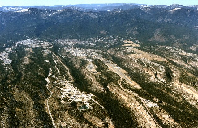 #1
#1 #2
#2 #3
#3