Save town Compare Needs More Love
Town guide

Ontonagon

A village of 1,355 people in Michigan
Be the first to joinEarn karma for joining →
1

Now in Ontonagon

What’s happening this week

All posts →
From your neighbors

What’s happening

A preview of what neighbors share. Be the first to post in Ontonagon.

Weather

Forecast →
Coming up

Upcoming events

Nothing on the calendar yet

Put the next local happening — a market, a meeting, a concert — on the map.

Add an event →
2

Around town

The places and views that make it Ontonagon

Explore places →

Outdoors in Ontonagon

Parks & trails →
Map of Ontonagon: conserved land, trails and the top places to walk
Conserved land0.1%3 of 2,442 acres
Trails4.4 mi1.2 mi per sq mi
Parks & preserves82 conserved acres per 1,000 residents

Trails & parks © OpenStreetMap contributors · Conserved land: USGS PAD-US

3

Know Ontonagon

The town at a glance, and the guide to how things work

Open the full guide →

About Ontonagon

Village in Michigan, United States
1,285Population
3.9 sq miArea
617 ftElevation

Ontonagon ( ON-tə-NAH-gən is a village in the Upper Peninsula of the U.S. state of Michigan. The population was 1,285 at the 2020 census. It is the county seat of Ontonagon County, and is the only incorporated place within the county. The village is located within Ontonagon Township, at the mouth of the Ontonagon River on Lake Superior. Industry was centered on the Smurfit-Stone Container production facility at the river mouth until the plant closed in 2010.

Official town website ↗

From Wikipedia, licensed CC BY-SA 4.0 · facts via Wikidata (CC0)

Town numbers

ZIP code49953
Living in Ontonagon

Work & commute in Ontonagon

Full picture →

About one in 3 of Ontonagon’s working residents works in town. The top destinations are Ontonagon (41%), Baraga (5%) and Houghton (4%). Half commute less than 23 miles.

Ontonagon
41%
Baraga
5%
Houghton
4%
Escanaba
3%
Census LEHD 2021 · ACSWork & commute in Ontonagon →

Health in Ontonagon

C−

Health Grade C−

Healthier than 20% of U.S. towns on seven CDC estimates, and 48% of towns with similar incomes.

Compared with Michigan

4better than MI·12worse

of 32 measures CDC estimates. The other 16 are too close to call.

BetterToo close to callWorse

What stands out

Care nearby

Up Health System PortageHancock · 39.2 mi · ER
Ontonagon Family Health CenterOntonagon · 0.5 mi · sliding-scale fees
Primary careShortage · county-wide
DentalShortage · county-wide
Mental healthShortage · county-wide
CDC PLACES 2025 · modeled estimates for adults · CDC's estimate for Ontonagon · CMS · HRSAHealth in Ontonagon →

Natural hazards in Ontonagon

FEMA National Risk Index December 2025 · OpenFEMANatural hazards in Ontonagon →

Climate in Ontonagon

Full climate →

Ontonagon has cold, snowy winters and cool summers. A typical July afternoon reaches 76°, a January night drops to 9°, and about 178 inches of snow falls in a normal winter.

27° / 11°Winter
49° / 28°Spring
74° / 53°Summer
54° / 37°Fall
NOAA U.S. Climate Normals, 1991–2020Climate in Ontonagon →

Ontonagon’s library

Library details →
Ontonagon Township Library311 North Steel Street · part of Ontonagon Township Library
Fine-freeE-books34 hrs a week
IMLS Public Libraries Survey · FY2024Ontonagon Township Library →
Famous people from OntonagonWriters, athletes, leaders and more who were born in Ontonagon.Meet them →

Where Ontonagon is

Explore map →
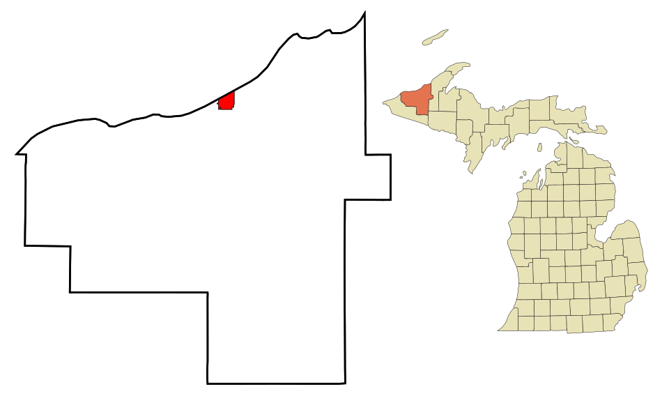
Locator map of Ontonagon
Wikimedia Commons · Map: Arkyan · CC BY-SA 3.0

Location map

Around town

Bordering towns

Explore map →
Ontonagon Ontonagon Ontonagon
Where Ontonagon residents work nearby:Ontonagon 41%Work & commute →
Compare side by side:Ontonagon vs Ontonagon

How things work in Ontonagon

All explainers →
The coffee’s on

Where to, neighbor?

You’re in Ontonagon, MIView boundary

Nearby

All towns & citiesExplore the map
Loading boundary…

Ontonagon is your selected town. The feed includes posts assigned to this town, not a distance radius or ZIP code.

Neighborhoods narrow the feed further, while townwide announcements, events, and issues remain visible.

Boundary source: https://tigerweb.geo.census.gov/arcgis/rest/services/TIGERweb/Places_CouSub_ConCity_SubMCD/MapServer/18 · 2025-01-01