The story
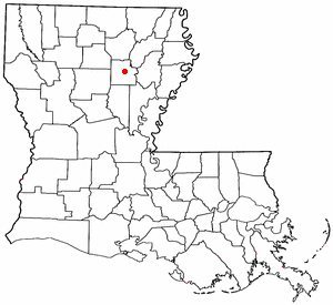
from WikipediaRead it all ↗The land that became Columbia was first cleared by Daniel Humphries in 1827. A store was built a few years later the only settlement between Monroe, Louisiana, and the settlements of the Black River was formed. The harbor became a busy port for shipping cotton by steamboats and Packet boats until the arrival of the railroad. In February 1864 Columbia was the location of a skirmish between Federal and Confederate troops during the Civil War and there are several plantations in the area.
Text from Wikipedia, licensed CC BY-SA 4.0.
Start Columbia’s collection
The first neighbors to add old photos shape how Columbia’s history is told.
0 of 10 decades since 1900 have photos 📦Share a family photoSign in to add one+10Columbia, decade by decade
2000
5 historic places in Columbia
Columbia has 5 listings on the National Register, and they protect 22 historic buildings, because Downtown Columbia Historic District alone counts 15.
Where they are
When they were listed
 Listed 1982First United Methodist Church
 Listed 1986Shepis Building
 Listed 1995Blanks House
 Listed 1996Downtown Columbia Historic DistrictListed 1993Martin House
Then & now
When neighbors add old photos, retakes from the same spot appear here side by side.
From Wikimedia Commons (4) and the National Register (2). Images are copied here with their credits and licenses, shown on each photo’s page. Refreshed monthly.