The story so far
from Wikipedia & the U.S. CensusRabbit Hash is an unincorporated community and census-designated place (CDP) in Boone County, Kentucky, United States. The population was 254 at the 2020 census. It is listed on the National Register of Historic Places. The town is notable for its name, its string of canine mayors, and its historic general store (c. 1831) which was largely destroyed by fire in 2016.
Between the 2010 and 2020 censuses its population fell from 315 to 254 (-19%). Half of its homes were built before 1974.
Wikipedia doesn’t have a history of Rabbit Hash yet — the old photos, dates and memories neighbors add here are how it gets written.
Intro from Wikipedia, licensed CC BY-SA 4.0. Population and housing: U.S. Census Bureau.
Start Rabbit Hash’s collection
The first neighbors to add old photos shape how Rabbit Hash’s history is told.
0 of 10 decades since 1900 have photos 📦Share a family photoSign in to add one+10Rabbit Hash, decade by decade
2000
 LOCPorch scene in the little Ohio River "country town" of Rabb…2020
 LOCScene in the little Ohio River "country town" of Rabbit Has…2020
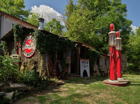 LOCScene in the little Ohio River "country town" of Rabbit Has…2020
 LOCOne of several countrified spots in the tiny settlement of …2020
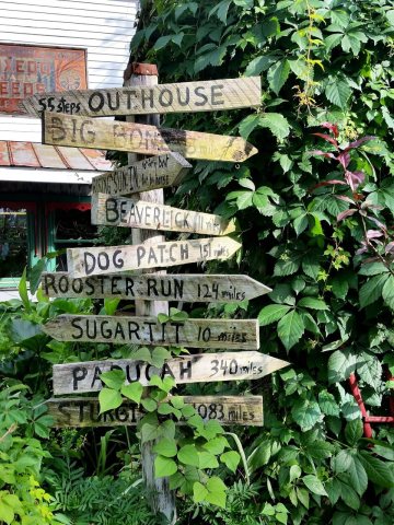 CommonsSignage in the Rabbit Hash Historic District2015
 CommonsAntique Barn in the Rabbit Hash Historic District2015
5 historic places in Rabbit Hash
Rabbit Hash has 5 listings on the National Register, and they protect 19 historic buildings, because Rabbit Hash Historic District alone counts 12.
Where they are
When they were listed
 Listed 1989Rabbit Hash General Store
 Listed 2003Rabbit Hash Historic DistrictListed 1974Piatt's LandingListed 1989B. C. Calvert HouseListed 1989East Bend Church
Then & now
When neighbors add old photos, retakes from the same spot appear here side by side.
Stories next door
nearby towns’ historyFrom Wikimedia Commons (2) and the Library of Congress (4). Images are copied here with their credits and licenses, shown on each photo’s page. Refreshed monthly.