The story
from WikipediaRead it all ↗Before and after the Civil War, Shawnee served as a government road that connected Fort Leavenworth to Fort Riley. During the mid 19th century, branches of the Oregon Trail and nearby Santa Fe Trail that passed through Olathe, Overland Park and Kansas City, Missouri saw settlers travel through the area. A Shawnee Indian mission had been established at the present site of Shawnee in 1831. Shawnee was laid out as a town in 1857. Kansas entered the union as a free state on January 29, 1861, to become the 34th state. The declaration of a free state added to the tension between the anti-slave abolitionists and pro-slave Confederate guerrillas.
Text from Wikipedia, licensed CC BY-SA 4.0.
Timeline
built from the dates on the items belowStart Shawnee’s collection
The first neighbors to add old photos shape how Shawnee’s history is told.
1 of 10 decades since 1900 have photos 🔁Retake an old viewPresident Ronald Reagan with Terr…, 1983: stand where they stood+15 📦Share a family photoSign in to add one+10Shawnee, decade by decade
1990s
Then & now
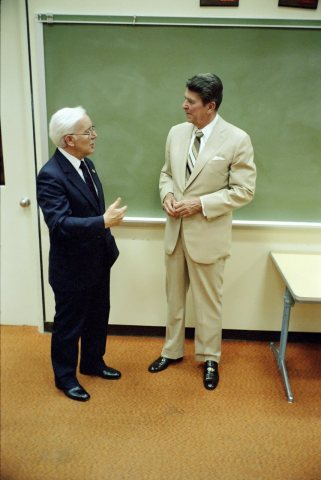
No then-and-now pairs yet. Take a photo from the same spot as President Ronald Reagan with Terrel Bell During Trip to Shawnee Mission Northwest High School in Shawnee Kansas - DPLA … (1983) and it appears here side by side.
🔁 Retake this view · +15Stories next door
nearby towns’ historyFrom Wikimedia Commons (6). Images are copied here with their credits and licenses, shown on each photo’s page. Refreshed monthly.