The story
from WikipediaRead it all ↗For millennia, the Great Plains of North America were inhabited by nomadic Native Americans. In the 1820s, the federal government reserved this area for use by the Shawnee people, who had ceded their lands east of the Mississippi River to the United States. In 1839, Methodists established the Shawnee Methodist Mission here to operate a school for the Shawnee and try to convert them to Christianity. Later it was named the Shawnee Indian Manual Labor School and also accepted Native American boarding students, then closed in 1862. The site is now owned by the Kansas Historical Society, designated as a National Historic Landmark, and is operated by the city of Fairway as a museum.
Text from Wikipedia, licensed CC BY-SA 4.0.
Start Fairway’s collection
The first neighbors to add old photos shape how Fairway’s history is told.
0 of 10 decades since 1900 have photos 📦Share a family photoSign in to add one+10Famous people from Fairway
See all 1 →
Fairway, decade by decade
2000
Then & now
When neighbors add old photos, retakes from the same spot appear here side by side.
Historic places
National Register · via Wikidata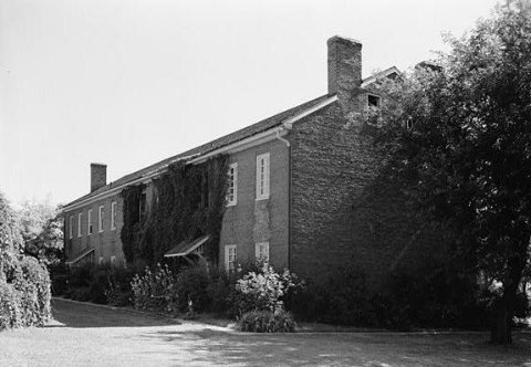
From Wikimedia Commons (1) and the National Register (1). Images are copied here with their credits and licenses, shown on each photo’s page. Refreshed monthly.