The story
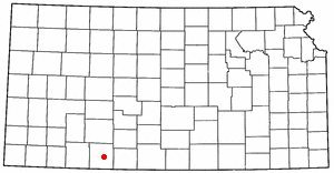
from WikipediaRead it all ↗Ashland lies along what was once a military road from Fort Dodge (now Dodge City, Kansas) to the north and Fort Supply in the Indian Territory to the south. In 1870, during the Comanche Campaign against the Native Americans, the Army built two redoubts along the Dodge/Supply trail near the current site of Ashland: the Bear Creek Redoubt, five miles to the north, and the Cimarron Redoubt, nine miles to the south.
Founded in 1884, it was named after the city of Ashland, Kentucky. The first post office in Ashland was established in 1885.
Text from Wikipedia, licensed CC BY-SA 4.0.
Start Ashland’s collection
The first neighbors to add old photos shape how Ashland’s history is told.
0 of 10 decades since 1900 have photos 📦Share a family photoSign in to add one+10Famous people from Ashland
See all 3 →

Ashland, decade by decade
2000
5 historic places in Ashland
5 places in Ashland are on the National Register of Historic Places, the country’s official list of buildings and places worth saving.
Where they are
When they were listed
 Listed 1972Stockgrowers State Bank
 Listed 2001Stein House
 Listed 2005Ashland Grade School
 Listed 2015Girl Scout Little HouseListed 2019Hodson Hotel
Then & now
When neighbors add old photos, retakes from the same spot appear here side by side.
Stories next door
nearby towns’ historyFrom Wikimedia Commons (2) and the National Register (4). Images are copied here with their credits and licenses, shown on each photo’s page. Refreshed monthly.