The story
from WikipediaRead it all ↗The Tongva village of Motuucheyngna was located in what is now Seal Beach in the area of the Los Cerritos Wetlands. It was part of the greater area of Puvungna, which was a major ceremonial and regional trading center for the Tongva and Acjachemen. Villagers used te'aats to travel out to villages on Pimu (Santa Catalina Island) and other islands off the coast, now referred to as the Channel Islands. In 2003, a burial site of the village was disturbed in a 196-acre (79 ha) Seal Beach residential development, Hellman Ranch, that was met with opposition from the Tongva.
Text from Wikipedia, licensed CC BY-SA 4.0.
Start Seal Beach’s collection
The first neighbors to add old photos shape how Seal Beach’s history is told.
0 of 10 decades since 1900 have photos 📦Share a family photoSign in to add one+10Famous people from Seal Beach
See all 8 →

Seal Beach, decade by decade
2000
Then & now
When neighbors add old photos, retakes from the same spot appear here side by side.
Historic places
National Register · via Wikidata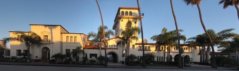
From Wikimedia Commons (3) and the National Register (1). Images are copied here with their credits and licenses, shown on each photo’s page. Refreshed monthly.