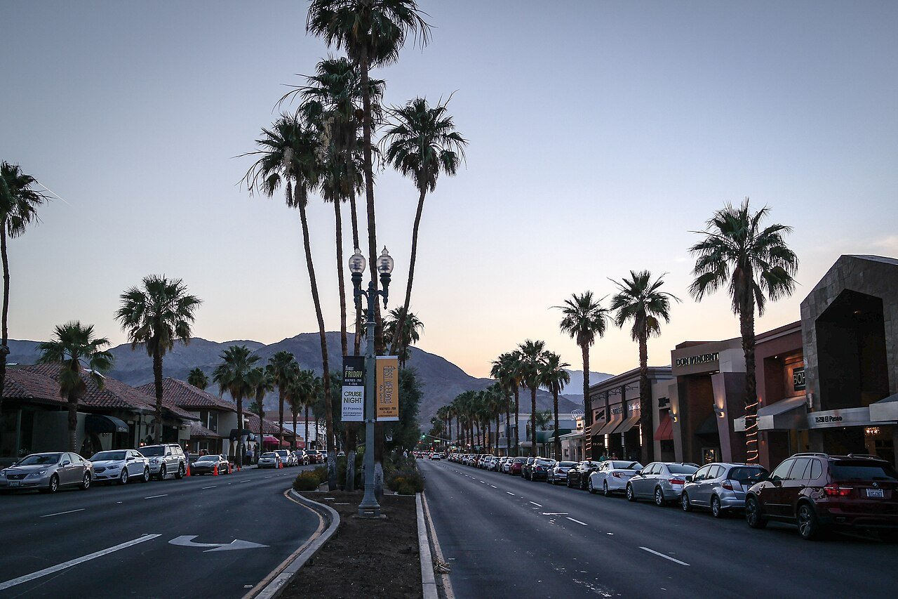
Outdoors in Palm Desert Waterfalls, trails & woods in Palm Desert About 7.4% of Palm Desert is conserved land, roughly 1,273 acres. There are about 56 miles of mapped trails, and the biggest networks are in Santa Rosa and San Jacinto Mountains National Monument (13.8 mi), Civic Center Park (1.4 mi), and Ironwood Park (0.8 mi).
Conserved land
7.4%
1,273 of 17,203 acres
Trails
56 mi
2.1 mi per sq mi · 14 on conserved land
Parks & preserves
15
24 conserved acres per 1,000 people
Bike routes
65 mi
53 mi lanes · 4.4 mi paths
What kind of outdoors town is Palm Desert? Read from the map. The page puts what stands out first.
The map Conserved land, trails & bike routes Tap a number to zoom to a park. Tap a layer to hide it.
🏊 Ironwood Pool 🏊 Lower Mirage Pool 🏊 Upper Mirage Pool 🏊 Unnamed public pool 🛝 Tot Lot 🛝 Unnamed playground in Civic Center Park 🛝 Unnamed playground in Civic Center Park 🛝 Unnamed playground in Joe Mann Park 🛝 Unnamed playground 🛝 Unnamed playground in University Park East 🛝 Unnamed playground in University Park East 🐕 Unnamed dog park in Civic Center Park 🐕 Unnamed dog park 🐕 Unnamed dog park in Joe Mann Park 🐕 Unnamed dog park 🐕 Unnamed dog park 💧 Unnamed waterfall 💧 Unnamed waterfall 💧 Unnamed waterfall 💧 Unnamed waterfall 💧 Unnamed waterfall 💧 Unnamed waterfall 💧 Unnamed waterfall 💧 Unnamed waterfall 💧 Unnamed waterfall 💧 Unnamed waterfall 💧 Unnamed waterfall 💧 Unnamed waterfall 💧 Unnamed waterfall 🧺 Unnamed picnic area in Cahuilla Hills Park 1 2 3 4 5 6
Show all of Palm Desert
★ What stands out · Things to do 30 places to go in Palm Desert Beaches, playgrounds, peaks, falls and more. Pick a kind.
🏊 4 Public pools 🛝 7 Playgrounds 🐕 5 Dog parks 💧 13 Waterfalls 🧺 1 Picnic area
Public pools in Palm Desert Show all on map
Playgrounds in Palm Desert Show all on map
🛝 Unnamed playground in Civic Center Park
Map Directions 🛝 Unnamed playground in Civic Center Park
Map Directions 🛝 Unnamed playground in University Park East
Map Directions 🛝 Unnamed playground in University Park East
Map Directions
Dog parks in Palm Desert Show all on map
🐕 Unnamed dog park in Civic Center Park
Map Directions
Waterfalls in Palm Desert Show all on map
5 more waterfalls
Picnic areas in Palm Desert Show all on map
🧺 Unnamed picnic area in Cahuilla Hills Park
Map Directions
Biking & sports 65 miles of bike routes Bike lanes are often missing from the map in smaller towns, so that number is likely low.
53 mi
painted or protected bike lanes
4.4 mi
off-road bike paths
7.6 mi
shoulders & shared lanes
Courts & fields
236 Tennis
154 Pickleball
16 Golf
15 Basketball
14 Baseball
7 Beach volleyball
2 Football
1 Skate park
Includes school and college facilities, which aren’t always open to the public.
Places to walk Pick a walk The longest trail network is Santa Rosa and San Jacinto Mountains National Monument, with 13.8 miles. Directions go to the nearest trailhead or public parking.
All 6 Under 1 mi 4 1–3 mi 1 3+ mi 1 100+ acres 1
1 Santa Rosa and San Jacinto Mountains National Monument Managed by United States Forest Service;Bureau of Land Management
1,707 acres13.8 mi of trail
Hopalong Cassidy Trail Art Smith Trail Herb Jeffries Trail Mike Schuler Trail +1
🐕 Dog rules not recorded
2 Civic Center Park Park
52 acres1.4 mi of trail
🐕 Dog rules not recorded
No trailhead mapped yet
3 Ironwood Park Park
16 acres0.8 mi of trail
Little Bend Trail
🐕 Dog rules not recorded
4 Cahuilla Hills Park Nature preserve
28 acres0.7 mi of trail
Gabby Hayes Hopalong Cassidy Trail Herb Jeffries Trail
🐕 Dog rules not recorded
5 G. George and Kathleen S. Fox Hiking Park Nature preserve
31 acres0.4 mi of trail
Herb Jeffries Trail
🐕 Dog rules not recorded
6 Palma Village Park Park
2 acres0.3 mi of trail
🐕 Dog rules not recorded
All 15 parks & preserves 🌲 Santa Rosa and San Jacinto Mountains National Monument 1,707 acres · 13.8 mi of trail · United States Forest Service;Bureau of Land Management
Directions 🌳 Civic Center Park 52 acres · 1.4 mi of trail
🌳 Ironwood Park 16 acres · 0.8 mi of trail
Directions 🌲 Cahuilla Hills Park 28 acres · 0.7 mi of trail
Directions 🌲 G. George and Kathleen S. Fox Hiking Park 31 acres · 0.4 mi of trail
Directions 🌳 Palma Village Park 2 acres · 0.3 mi of trail
Directions 🌲 Cap Homme / Ralph Adams Park 29 acres · 0.2 mi of trail
🌲 Boyd Deep Canyon Desert Research Center 48 acres · Natural Reserve System, University of California
🌳 Hovley Soccer Park 24 acres
🌳 Magnesia Falls City Park 8 acres
🌳 University Park East 3 acres · City of Palm Desert
🌳 Washington Charter School Park 2 acres
Trails & water
7 named trails and 2 lakes & rivers Named trails
Open to bikes · 4.5 mi Horses · 2.4 mi Unpaved · 5.4 mi
Hopalong Cassidy Trail 6.4 mi
Art Smith Trail 1.4 mi
Herb Jeffries Trail 0.9 mi
Gabby Hayes 0.5 mi
Mike Schuler Trail 0.4 mi
Art Smith trail 0.1 mi
Little Bend Trail 0.1 mi
Lakes & rivers tap for directions
Who protects it 1,273 conserved acres Who manages Palm Desert’s conserved land, from the USGS Protected Areas Database. Approximate, because parcels can overlap.
Town or city 480 ac
Joint 397 ac
State fish & wildlife 275 ac
Regional agency 72 ac
Other state land 51 ac
Unknown Easement · 397 ac Local Other or Unknown · 333 ac State Conservation Area · 275 ac Local Park · 181 ac State Other or Unknown · 51 ac
Good to know Conserved doesn’t always mean open to visitors. 395 acres are conservation easements, usually private land. The walks above are places people visit.
The biggest protected places
Place Managed by Acres Public access
Santa Rosa and San Jacinto Mountains National MonumentLocal Other or Unknown
Town or city 319 Open Santa Rosa Wildlife AreaState Conservation Area
State fish & wildlife 275 Open Palm Desert Civic Center ParkLocal Park
Town or city 51 Open Boyd Deep Canyon Desert Research CenterState Other or Unknown
Other state land 51 Restricted The Living Desert Zoo & GardensLocal Park
Town or city 36 Open Cahuilla Hills ParkLocal Park
Regional agency 29 Open Freedom ParkLocal Park
Town or city 24 Open Hovley Soccer ParkLocal Recreation Area
Town or city 20 Open Cook Fields Sports ComplexLocal Recreation Area
Regional agency 19 Open Ironwood ParkLocal Park
Town or city 15 Open
5 smaller protected places aren’t shown.
History along the way
2 historic sites to visit History → 🏛️ Desert Holocaust Memorial In Civic Center Park · Memorial
Directions Next door Palm Desert and its neighbors Palm Desert has the most mapped trails of the 4 towns around it. Tap a town to see its outdoors.
Trail talk Conditions, parking and favorite walks from Palm Desert neighbors.
Town Square →
Weigh in
Is Santa Rosa and San Jacinto Mountains National Monument the best walk in Palm Desert?
Yes I know a better one
Your answer becomes a post in Town Square.
Share a tip
Trail muddy, icy or closed? Give neighbors a heads-up → Where do you park for Santa Rosa and San Jacinto Mountains National Monument? → Are dogs allowed at Santa Rosa and San Jacinto Mountains National Monument? → What’s your favorite walk in Palm Desert? →
Trails, parks, preserves, courts and bike lanes © OpenStreetMap contributors (ODbL), map data as of 2026-09-28. Conserved land: USGS Gap Analysis Project, PAD-US . Measured against the Census town boundary.
How we measure "Trails" are OpenStreetMap paths, bridleways, public tracks and unpaved footways, plus footways inside a park or preserve or on a named trail route. Sidewalks are left out. Areas are counted on a 26.5-meter grid, so overlapping parcels count once. "Conserved" includes conservation easements, which protect land from development but are usually private property. Trailheads are the nearest marked trailhead, public parking lot or information board within about 150 meters of a preserve. Dog rules come from OpenStreetMap when someone has tagged them; otherwise we show what’s typical for the land manager, or say the rules aren’t recorded.