The story
from WikipediaRead it all ↗Damascus is a town located in the Ozark foothills on a plateau surrounded by clear streams along U.S. Highway 65 on the county line between Faulkner and Van Buren counties. It is most known for its proximity to the Titan II missile base that operated from 1963 until 1980, when a missile explosion killed one person and injured twenty-one. Damascus is home to three Baptist churches, a Church of Christ that was built in 1917, and a Methodist church that was built in 1947.
Damascus is also near the Gus Blass Scout Reservation, a Boy Scout Camp of 3,000 acres maintained by the Quapaw Area Council.
Text from Wikipedia, licensed CC BY-SA 4.0.
Timeline
built from the dates on the items belowStart Damascus’s collection
The first neighbors to add old photos shape how Damascus’s history is told.
1 of 10 decades since 1900 have photos 🔁Retake an old view"The bin is empty," says this fat…, 1930: stand where they stood+15 📦Share a family photoSign in to add one+10Famous people from Damascus
See all 1 →Damascus, decade by decade
1990s
6 historic places in Damascus
6 places in Damascus are on the National Register of Historic Places, the country’s official list of buildings and places worth saving.
Where they are
When they were listed
 Listed 2002Damascus CCC Camp, Co. No. 3781 Historic District
 Listed 2005Lee Service Station
 Listed 2005Melvin Chrisco House
 Listed 2005Carl and Esther Lee House
 Listed 2006Earl and Oza Crownover-Brown HouseListed 1992Damascus Gymnasium
Then & now
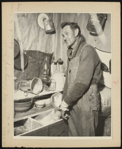
No then-and-now pairs yet. Take a photo from the same spot as "The bin is empty," says this father of a large family to the Red Cross visitor (1930) and it appears here side by side.
🔁 Retake this view · +15Stories next door
nearby towns’ historyFrom the Library of Congress (1). Images are copied here with their credits and licenses, shown on each photo’s page. Refreshed monthly.