The story
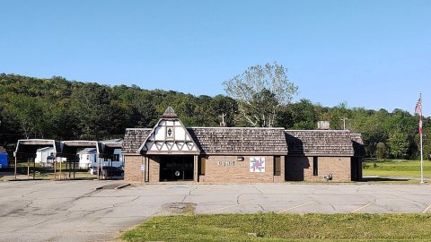
from WikipediaRead it all ↗Altus had its start in 1875 when the railroad was extended to that point. Altus station was the highest point on the track. In recognition of this highest railroad elevation between Little Rock and Fort Smith, the station was originally known as "Summit". The town's initial development was due to railroad efforts encouraging German immigration to settle lands adjacent to the railroad. In 1903, the railroad mainline was shifted to a more favorable alignment along the Arkansas River. The track through Altus was removed in the 1930s, but the railroad station has been preserved as a commercial establishment.
Text from Wikipedia, licensed CC BY-SA 4.0.
Start Altus’s collection
The first neighbors to add old photos shape how Altus’s history is told.
0 of 10 decades since 1900 have photos 📦Share a family photoSign in to add one+10Famous people from Altus
See all 3 →Altus, decade by decade
2000



7 historic places in Altus
7 places in Altus are on the National Register of Historic Places, the country’s official list of buildings and places worth saving.
Where they are
When they were listed
 Listed 1976Our Lady of Perpetual Help Church
 Listed 1990German-American Bank
 Listed 1991O'Kane-Jacobs House
 Listed 1992Missouri-Pacific Depot-Altus
 Listed 1992Center Cross School
 Listed 1996Altus Well Shed-Gazebo
 Listed 2010Johnson County Line-Ozark-Crawford County Line Road, Altus Segment
Then & now
When neighbors add old photos, retakes from the same spot appear here side by side.
Stories next door
nearby towns’ historyFrom Wikimedia Commons (5) and the National Register (1). Images are copied here with their credits and licenses, shown on each photo’s page. Refreshed monthly.