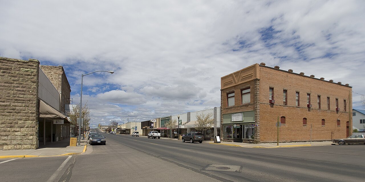
BurnsOR
A town of 2,723, settled in 1889. A typical home worth about $193K.
What makes Burns stand out
The 3 things Burns does most differently from other towns.
Burns’s report card
Now in Burns
What neighbors are saying. Town Square →
Weather
Forecast →Local news
All →- Burns vs Nyssa - Girls Varsity Volleyball 10/01/2026 | Watch Live & On DemandNFHS Network · Oct 1
- Brian Burns, Andrew Thomas injured in fourth quarterYahoo Sports · Sep 21
- Game Recap: Varsity Football Weiser High School vs. Burns High SchoolNFHS Network · Sep 18
Upcoming events
Nothing on the calendar.
The data
Ordered by what stands out in Burns. Another town gets a different order.
A typical Burns home is worth about $193K
The typical Burns home is worth about $193,000, up 3.6% in a year, 61% below the Oregon typical home.
Typical home value
About one in two working residents works right in Burns
41% of Burns’s working residents work right in town. The top destinations are Hines (13%), Bend (4%) and Redmond (2%). Half commute less than 2 miles.
Where working residents work
Burns’s public schools outperform 61% of Oregon districts
The public schools Burns’s kids attend, from kindergarten through graduation, outperform 61% of Oregon’s districts on state tests and graduation. Among towns with similar incomes, they rank near the top.
| School | Grades | Students | Grade |
|---|---|---|---|
| Henry L Slater Elementary School | K–5 | 297 | B− |
| Burns High School | 9–12 | 215 | A− |
| Monroe School | 6–12 | 15 | Not graded |
| Burns High Desert Academy | K–12 | 7 | Not graded |
Healthier than 16% of U.S. towns
Burns beats the Oregon average on 1 of 26 CDC measures and trails it on 13.
| What stands out | Burns | OR |
|---|---|---|
| More adults treating high blood pressure | 75.6% | 71.4% |
| More adults with COPD | 10.9% | 6.8% |
Four seasons, pleasant summers
Burns has chilly winters and warm summers, with very little rain. A typical July afternoon reaches 87°, a January night drops to 17°.
Typical low → high °F
High risk, with inland flooding at the top
Expected storm and flood damage is higher than in 62% of U.S. communities.
2.1% of Burns is conserved land
1.4 miles of trails across 3 parks and preserves.
| Biggest places to walk | Trails | Acres |
|---|---|---|
| 1. Memorial Field | — | 5 |
| 2. Washington Park | — | 2 |
| 3. Triangle Park | — | 2 |
About Burns
City in Oregon, United States
Burns is a city in and the county seat of Harney County, in the U.S. state of Oregon. According to the 2020 census, the population was 2,730. Burns and the nearby city of Hines are home to about 60 percent of the people in the sparsely populated county, by area the largest in Oregon and the tenth largest in the United States. The Burns–Hines region has a high-desert climate but was much wetter in the recent geologic past. The Harney Basin was the largest of many depressions in which lakes formed in southeastern Oregon during the late Pleistocene. Remnants of an ancient lake that reached as far north as Burns are at the center of the Malheur National Wildlife Refuge, south of the city. North…
From Wikipedia, licensed CC BY-SA 4.0 · facts via Wikidata (CC0)
- Established
- 1889
- Population
- 2,730
- Area
- 3.6 sq mi
- Elevation
- 4,147 ft
- ZIP code
- 97720
- Area code
- 541