Ramapo

What’s happening
Weather
Forecast →Upcoming events
Put the next local happening — a market, a meeting, a concert — on the map.
Local news
Headlines via Google News · Articles belong to their publishers.
The Ramapo album
About Ramapo
Town in New York, United StatesRamapo (English pronunciation: /ˈɹæːməpoʊ/ ) is a town in Rockland County, New York, United States. It was originally formed as New Hampstead, in 1791, and became Ramapo in 1828. It shares its name with the Ramapo River. As of the 2020 census, Ramapo had a total population of 148,919, making it the most populous town in New York outside of Long Island. If all towns in New York were cities, Ramapo would be the 12th-largest city in the state of New York. The town's name, recorded variously as Ramopuck, Ramapock, or Ramapough, is of Lenape origin, meaning either "sweet water" or "slanting rocks". Early maps referred to Ramapo as Ramepog (1695), Ramepogh (1711), and Ramapog (1775). The town is …
From Wikipedia, licensed CC BY-SA 4.0 · facts via Wikidata (CC0)
How Ramapo ranks
All →Town numbers
Schools in Ramapo
All 66 schools →School data from the U.S. Department of Education (NCES). Ratings are from neighbors.
Where Ramapo is
Explore map →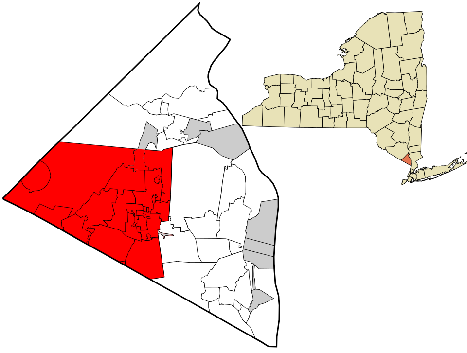

Location map