Town guide
Ossipee
A town of 4,521 people in Carroll County, New Hampshire

From your neighbors
What’s happening
Coming up
Upcoming events
Nothing on the calendar yet
Add an event →Put the next local happening — a market, a meeting, a concert — on the map.
Around town
All news →Local news
Headlines via Google News · Articles belong to their publishers.
The Ossipee album
0 of 12 shotsNeighbors document Ossipee together
About Ossipee
Town in New Hampshire, United States1785Established
4,372Population
75.6 sq miArea
682 ftElevation
Ossipee is a town in Carroll County, New Hampshire, United States. The population was 4,372 at the 2020 census, and an estimated 4,599 in 2025. It is the county seat of Carroll County. Ossipee, which includes several villages, is a resort area and home to part of Pine River State Forest.
From Wikipedia, licensed CC BY-SA 4.0 · facts via Wikidata (CC0)
Town numbers
ZIP code03864
Area code603
Schools in Ossipee
In the guide →
See how Ossipee’s schools compare in NH →
DistrictGovernor Wentworth Regional School DistrictSchools3
Ossipee Central SchoolElementary · Grades PK–6 · 276 students
North Star Academy Chartered Public SchoolGrades M
CORNERSTONE CHRISTIAN ACADEMY
School data from the U.S. Department of Education (NCES). Ratings are from neighbors.
Where Ossipee is
Explore map →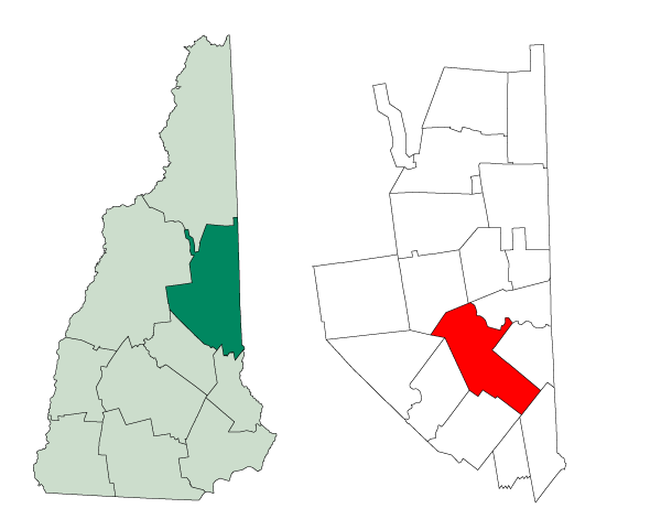

Location map
New Hampshire · NH · Carroll CountyTown boundary on OpenStreetMap →
Around town
Explore map →Bordering towns
How things work in Ossipee
All explainers →No one has written Ossipee’s explainers yetKnow how one of these works here? Each explainer earns +10 karma.