Sign inJoin
Minnesota›Pine County

Kettle RiverMN

A town of 531.

Population
531
−5% since 2010
Median home value
$236K
Census ACS
Household income
$66K
median
Median age
41.0
years
Jobs based here
34
A commuter town
Small town

531 people, and everyone knows the way

In a town this size, neighbors are the best guide. Ask them anything.

Nearby towns
Willow RiverRutledgeFinlaysonSturgeon LakeNormanBremenPine LakeWillow RiverRutledgeFinlaysonSturgeon LakeNormanBremenPine LakeKettle River

Kettle River’s report card

See the data ↓

Now in Kettle River

Be the first to start the conversation.

Be the first neighbor to joinJoin Kettle River →
Start a conversation

Upcoming events

Nothing on the calendar.

The data

Ordered by what stands out in Kettle River. Another town gets a different order.

Work & commute

Most working residents commute out of Kettle River

Most working residents leave Kettle River for work: only 0% work in town. The top destinations are Moose Lake (15%), Cloquet (7%) and Willow River (5%). Half commute less than 32 miles.

0%work in town

Where working residents work

In Kettle River0%
Moose Lake15%
Cloquet7%
Willow River5%
Duluth5%
32 mi
median commute distance
34
jobs based in Kettle River
A commuter town
jobs vs. working residents
Census LEHD 2023 · ACSCommute map →
Climate

Snowy winters, pleasant summers

Kettle River has cold, snowy winters and pleasant summers. A typical July afternoon reaches 80°, a January night drops to 1°, and about 64 inches of snow falls in a normal winter.

64″snow a winter

Typical low → high °F

Winter5–24°
Spring29–52°
Summer54–77°
Fall34–54°
Oct 2
typical first frost
May 12
typical last frost
+1.8°
vs. the 20th-century average
NOAA U.S. Climate Normals, 1991–2020Full climate →
Health

How healthy Kettle River is

Kettle River beats the Minnesota average on 0 of 32 CDC measures and trails it on 11.

32 measures vs. Minnesota
0 better21 too close to call11 worse
What stands outKettle RiverMN
More adults with COPD7.4%5.4%
More older adults who have lost all their teeth12%8.9%
More smokers17.6%13.1%
Essentia Health Moose Lake
12 mi away · emergency room
3 of 3
care shortages: primary care, dental, mental health
CDC PLACES 2025 · modeled estimates for adults · CMS · HRSAFull health report →
Natural hazards

Moderate risk, with inland flooding at the top

Expected storm and flood damage is higher than in 59% of U.S. communities.

59risk score of 100
FEMA risk score
59Moderate riskLowerHigher
Inland floodingCold waves
3
federal disasters paid out here
FEMA National Risk Index · OpenFEMANatural hazards →
Outdoors

5.7% of Kettle River is conserved land

3.6 miles of trails across 2 parks and preserves.

5.7%conserved
5.7%
conserved · 1,110 of 19,590 acres
3.6 mi
of trails · 0.1 per sq mi
Biggest places to walkTrailsAcres
1. Rutledge Wildlife Management Area—314
2. General C.C. Andrews State Forest0.1 mi39
Trails & parks © OpenStreetMap contributors · Conserved land: USGS PAD-USParks & trails →
A commuter town

100% of working residents leave Kettle River for work

Where Kettle River’s working residents go each day. Line width shows the share.

15% → Moose Lake Moose Lake 15% 7% → Cloquet Cloquet 7% 5% → Willow River Willow River 5% 5% → Duluth Duluth 5% 5% → Minneapolis Minneapolis 5% 4% → Hinckley Hinckley 4% Kettle River · 0% stay
34jobs based in Kettle River
0%of working residents work in town
32 mimedian commute distance

Census LEHD 2023

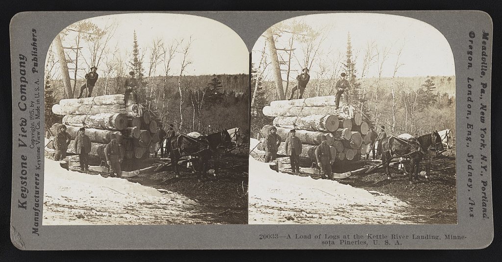
A load of logs at the Kettle River landing, Minnesota pineries, U.S.A
1915 · A load of logs at the Kettle River landing, Minnesota pineries, U.S.A · Library of Congress
Kettle River’s story

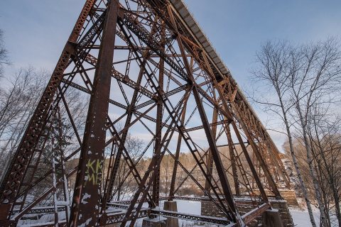
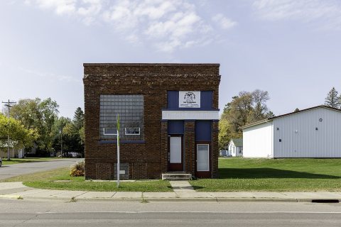
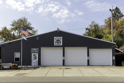
Kettle River in pictures

6 postcards, papers and photographs from public archives.

Rail Bridge Over the Kettle River - Sandstone Minnesota in WinterFarmer's State Bank buildingKettle River City Hall and Fire Department
Explore the history →

More about Kettle River

Post to Kettle River

We’ll email a one-tap link to publish your post. No password, and nothing is public until you click it.
Already a member? Sign in