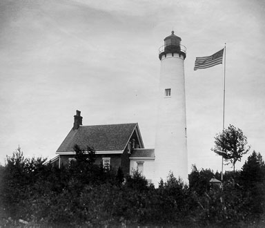
St. Ignace Mission · National Register of Historic Places
Moran’s story
Moran in pictures
4 places on the National Register of Historic Places.
Explore the history →A town of 998. Nearly 41.3% of it is conserved land.
The 3 things Moran does most differently from other towns.
In a town this size, neighbors are the best guide. Ask them anything.
Be the first to start the conversation.
Ordered by what stands out in Moran. Another town gets a different order.
237 miles of trails across 9 parks and preserves.
| Biggest places to walk | Trails | Acres |
|---|---|---|
| 1. Lake Superior State Forest - Sault Ste. Marie Unit | 132.7 mi | 32,286 |
| 2. Straits State Park | 0.8 mi | 77 |
| 3. Straits of Mackinac Underwater Preserve | — | 556 |
Expected storm and flood damage is higher than in 4% of U.S. communities.
The public schools Moran’s kids attend trail 72% of Michigan’s districts on state tests. Among towns with similar incomes, they rank near the bottom.
| School | Grades | Students | Grade |
|---|---|---|---|
| St Ignace ElementaryMiddle School | PK–8 | 240 | B− |
| Gros Cap School | PK–8 | 87 | C |
| LaSalle High School | 9–12 | 117 | B− |
Moran has cold, snowy winters and pleasant summers. A typical July afternoon reaches 76°, a January night drops to 10°, and about 81 inches of snow falls in a normal winter.
The typical Moran home is worth about $219,000, up 5.8% in a year, 18% below the Michigan typical home.
Most working residents leave Moran for work: only 8% work in town. The top destinations are St. Ignace (23%), Mackinac Island (16%) and Sault Ste. Marie (8%). Half commute less than 17 miles.
Moran beats the Michigan average on 4 of 32 CDC measures and trails it on 15.
| What stands out | Moran | MI |
|---|---|---|
| Fewer binge drinkers | 12.3% | 15.9% |
| More adults treating high blood pressure | 83.7% | 77.6% |
| More adults with heart disease | 12.3% | 7% |
41.3% of the town is conserved land, across 9 parks and preserves.
4 places on the National Register of Historic Places.
Explore the history →4 places in Moran on the National Register of Historic Places.
Civil township in Michigan, United States
Brevort Township ( breh-VORT) is a civil township of Mackinac County in the U.S. state of Michigan. As of the 2020 census, the population was 502, down from 594 in 2010. The township was named after Henry Brevort (or Brevoort), a surveyor assigned to subdivide the area in 1845. Most of the township land is within the eastern portion of the Hiawatha National Forest. The township includes part of the Mackinac Wilderness.
From Wikipedia, licensed CC BY-SA 4.0 · facts via Wikidata (CC0)