Guest, Sign inJoin
WelcomeToWashburn
Maine›Aroostook County

WashburnME

A town of 1,355. A typical home worth about $148K.

3 bordering townsMap →
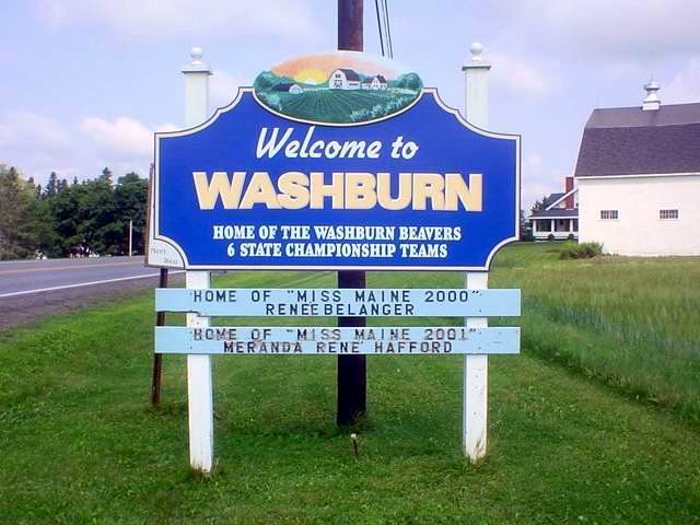
Photo: Adolphus79 (talk) · Public domain
Population
1,355
−9.5% since 2010
Typical home
$148K
+1.7% in a year
Household income
$56K
median
Median age
48.2
years
Jobs based here
252
A commuter town

What makes Washburn stand out

The 3 things Washburn does most differently from other towns.

Picked automatically from the data
Small town

1,355 people, and everyone knows the way

In a town this size, neighbors are the best guide. Ask them anything.

Nearby towns
MapletonWadeWoodlandMapletonWadeWoodlandWashburn

Washburn’s report card

See the data ↓

Now in Washburn

Be the first to start the conversation.

Be the first neighbor to joinJoin Washburn →
Residents weigh in
Live in Washburn? Is a D for health right?
Your answer becomes a post in Washburn’s Town Square.
Start a conversation
46°
Clear
Tonight L 27°

Upcoming events

Nothing on the calendar.

The data

Ordered by what stands out in Washburn. Another town gets a different order.

Housing

A typical Washburn home is worth about $148K

The typical Washburn home is worth about $148,000, up 1.7% in a year, 64% below the Maine typical home.

$148KZillow home value

Typical home value

Washburn$148K
Maine$416K
+1.7%
value change, 1 year
Zillow Home Value Index · Redfin Data CenterHousing market →
Health

Healthier than 14% of U.S. towns

Washburn beats the Maine average on 0 of 32 CDC measures and trails it on 15.

DHealth Grade
32 measures vs. Maine
0 better17 too close to call15 worse
What stands outWashburnME
More adults who get no exercise31.7%23.1%
More older adults who have lost all their teeth20.1%14.8%
More adults facing food insecurity13.8%10.7%
Cary Medical Center
7.6 mi away · emergency room
2 of 3
care shortages: dental, mental health
11th
percentile among ME towns
CDC PLACES 2025 · modeled estimates for adults · CMS · HRSAFull health report →
Schools

Washburn’s public schools outperform 23% of Maine districts

The public schools Washburn’s kids attend trail 77% of Maine’s districts on state tests. Among towns with similar incomes, they rank near the bottom.

C−School Grade
SchoolGradesStudentsGrade
Washburn District Elem SchoolPK–8180C−
Washburn District High School9–1291A−
NCES · EDFacts · graded within ME on state testsAll 2 schools →
Work & commute

Most working residents commute out of Washburn

Most working residents leave Washburn for work: only 9% work in town. The top destinations are Presque Isle (27%), Caribou (19%) and Bangor (4%). Half commute less than 10 miles.

9%work in town

Where working residents work

In Washburn9%
Presque Isle27%
Caribou19%
Bangor4%
Easton3%
10 mi
median commute distance
252
jobs based in Washburn
A commuter town
jobs vs. working residents
Census LEHD 2023 · ACSCommute map →
Natural hazards

Low risk, with cold waves at the top

Expected storm and flood damage is higher than in 27% of U.S. communities.

27risk score of 100
FEMA risk score
27Low riskLowerHigher
Cold wavesInland floodingHurricanes
4
paid flood claims since 1981
7
federal disasters paid out here
FEMA National Risk Index · OpenFEMANatural hazards →
Climate

Snowy winters, pleasant summers

Washburn has cold, snowy winters and pleasant summers. A typical July afternoon reaches 77°, a January night drops to 1°, and about 118 inches of snow falls in a normal winter.

118″snow a winter

Typical low → high °F

Winter5–24°
Spring27–49°
Summer52–75°
Fall35–53°
Oct 1
typical first frost
May 7
typical last frost
+1.6°
vs. the 20th-century average
NOAA U.S. Climate Normals, 1991–2020Full climate →
Safety

Crime reported in Washburn

Washburn's reported crime rate is well below Maine's. Violent crime is rare: 1 reported in 2023.

Violent crime per 1,000 residents

Washburn0.7
Maine1
U.S.3.9

Property crime per 1,000 residents

Washburn0.7
Maine11.4
U.S.19.5
1
violent crimes reported in 2023
1
property crimes reported in 2023
FBI crime data, 2023 · crimes reported to policeFull safety report →
Outdoors

1.2% of Washburn is conserved land

11 miles of trails across 3 parks and preserves.

1.2%conserved
Map of Washburn: conserved land, trails and the top places to walk
Green: conserved land · dashed: trails · numbers: the places below
1.2%
conserved · 262 of 22,209 acres
11 mi
of trails · 0.3 per sq mi
Biggest places to walkTrailsAcres
1. Caribou Stream Wildlife Management Area—614
2. Thomas Brewer Memorial Park—6
3. Mill Pond Recreation Park—5
Trails & parks © OpenStreetMap contributors · Conserved land: USGS PAD-USParks & trails →
A commuter town

91% of working residents leave Washburn for work

Where Washburn’s working residents go each day. Line width shows the share.

27% → Presque Isle Presque Isle 27% 19% → Caribou Caribou 19% 4% → Bangor Bangor 4% 3% → Easton Easton 3% 3% → Mars Hill Mars Hill 3% 3% → Woodland Woodland 3% Washburn · 9% stay
252jobs based in Washburn
9%of working residents work in town
10 mimedian commute distance

Census LEHD 2023

Washburn’s story

Washburn in pictures

1 places on the National Register of Historic Places.

Explore the history →
About Washburn

Town in Maine, United States

Washburn is a town in Aroostook County, Maine, United States. It was incorporated on February 25, 1861, and named after Israel Washburn, the governor of Maine at the time. The population was 1,527 at the 2020 census. Benjamin C. Wilder House, which was built in 1852, is located on Main Street in Washburn and predates the town's incorporation by nine years.

From Wikipedia, licensed CC BY-SA 4.0 · facts via Wikidata (CC0)

Population
1,527
Area
35 sq mi
Elevation
653 ft
ZIP code
04786
Area code
207

More about Washburn

Post to Washburn

We’ll email a one-tap link to publish your post. No password, and nothing is public until you click it.
Already a member? Sign in
Photo of Washburn

Washburn, ME · Photo: Adolphus79 (talk) · Public domain · Source ↗