Guest, Sign inJoin
Fort Duffield
1861 · from West Point’s archive

West PointKY

A town of 1,025, settled in 1789. Home to 8 places on the National Register of Historic Places.

1 bordering townMap →
Wikimedia Commons
Population
1,025
+19.4% since 2010
Typical home
$115K
−13.6% in a year
Household income
$37K
median
Median age
36.3
years
Jobs based here
35
A commuter town

What makes West Point stand out

The 2 things West Point does most differently from other towns.

Picked automatically from the data
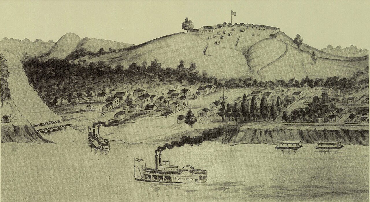
Fort Duffield
1861 · Fort Duffield · Wikimedia Commons
West Point’s story

237 years in pictures

6 postcards, papers and photographs from public archives, and 8 places on the National Register.

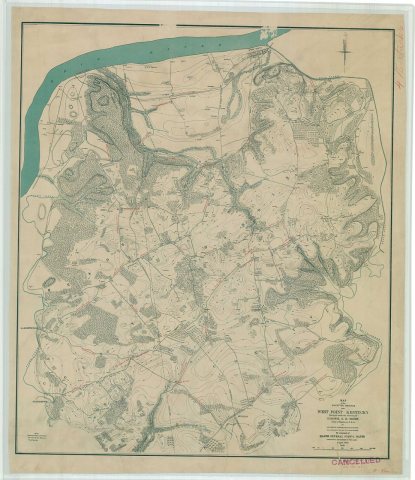
Map of the Maneuver Grounds nearIn cavalry headquarters, Campy YoungThe boys in blue have just come in sight of the enemy, maneuvers at West Point, Ky
Explore the history →
Small town

1,025 people, and everyone knows the way

In a town this size, neighbors are the best guide. Ask them anything.

Nearby towns
Louisville/Jefferson County metro governmentLouisville/Jefferson County metro governmentWest Point

West Point’s report card

See the data ↓

Now in West Point

Be the first to start the conversation.

Be the first neighbor to joinJoin West Point →
Start a conversation
68°
Clear
H 78° · L 49°

Upcoming events

Nothing on the calendar.

The data

Ordered by what stands out in West Point. Another town gets a different order.

Housing

A typical West Point home is worth about $115K

The typical West Point home is worth about $115,000, down 13.6% in a year, 51% below the Kentucky typical home.

$115KZillow home value

Typical home value

West Point$115K
Kentucky$233K
−13.6%
value change, 1 year
1
homes sold in February
Zillow Home Value Index · Redfin Data CenterHousing market →
Natural hazards

Very high risk, with inland flooding at the top

Expected storm and flood damage is higher than in 91% of U.S. communities.

91risk score of 100
FEMA risk score
91Very high riskLowerHigher
Inland floodingTornadoes
249
paid flood claims since 1978
4
federal disasters paid out here
FEMA National Risk Index · OpenFEMANatural hazards →
Work & commute

Most working residents commute out of West Point

Most working residents leave West Point for work: only 2% work in town. The top destinations are Shepherdsville (4%), Lexington-Fayette urban county (4%) and Watterson Park (3%). Half commute less than 20 miles.

2%work in town

Where working residents work

In West Point2%
Shepherdsville4%
Lexington-Fayette urban county4%
Watterson Park3%
Elizabethtown3%
20 mi
median commute distance
35
jobs based in West Point
A commuter town
jobs vs. working residents
Census LEHD 2023 · ACSCommute map →
Climate

Four seasons, pleasant summers

West Point has chilly winters and warm summers, with plenty of rain. A typical July afternoon reaches 87°, a January night drops to 25°, and about 15 inches of snow falls in a normal winter.

15″snow a winter

Typical low → high °F

Winter27–46°
Spring45–67°
Summer65–86°
Fall46–69°
Oct 24
typical first frost
Apr 19
typical last frost
+1.2°
vs. the 20th-century average
NOAA U.S. Climate Normals, 1991–2020Full climate →
Safety

Crime reported in West Point

No violent or property crimes were reported in West Point in 2025. In a town this small, a few incidents move the numbers a lot, so rates aren't shown.

West Point is small, so we show counts rather than rates.

0
violent crimes reported in 2025
0
property crimes reported in 2025
FBI crime data, 2025 · crimes reported to policeFull safety report →
Health

How healthy West Point is

West Point beats the Kentucky average on 0 of 5 CDC measures and trails it on 2.

5 measures vs. Kentucky
0 better3 too close to call2 worse
What stands outWest PointKY
More older adults who have lost all their teeth32.6%18.9%
Fewer adults seeing a dentist49.2%58.1%
Harrison County Hospital
17.7 mi away · emergency room
3 of 3
care shortages: primary care, dental, mental health
CDC PLACES 2025 · modeled estimates for adults · CMS · HRSAFull health report →
Outdoors

2.7% of West Point is conserved land

4.5 miles of trails across 2 parks and preserves.

2.7%conserved
Map of West Point: conserved land, trails and the top places to walk
Green: conserved land · dashed: trails · numbers: the places below
2.7%
conserved · 46 of 1,711 acres
4.5 mi
of trails · 1.7 per sq mi
Biggest places to walkTrailsAcres
1. Fort Duffield Park and Historic Site0.6 mi154
2. Veterans Memorial Park—4
Trails & parks © OpenStreetMap contributors · Conserved land: USGS PAD-USParks & trails →
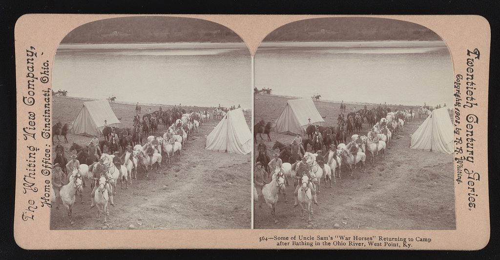
Some of Uncle Sam's "war horses" returning to camp after bathing in the Ohio River1903
From the archive · today’s picture

123 years ago in West Point

Some of Uncle Sam's "war horses" returning to camp after bathing in the Ohio River

Photo · Library of Congress. A different picture from West Point’s archive appears here every day.

See all 6 archive items →

Landmarks

8 places in West Point on the National Register of Historic Places.

All landmarks →

About West Point

City in Kentucky, United States

Official town website ↗

West Point is a home rule-class city in Hardin County, Kentucky, United States, near the edge of Fort Knox military reservation on Dixie Highway. It is located in a former meander bend of the Ohio River. The population was 952 as of the 2020 Census, up from 797 from the 2010 census, but still down from 1,100 at the 2000 census. West Point is part of the Elizabethtown–Fort Knox Metropolitan Statistical Area.

From Wikipedia, licensed CC BY-SA 4.0 · facts via Wikidata (CC0)

Established
1789
Population
952
Area
2.7 sq mi
Elevation
436 ft
ZIP code
40177
Area code
502

More about West Point

Post to West Point

We’ll email a one-tap link to publish your post. No password, and nothing is public until you click it.
Already a member? Sign in
Photo of West Point

1861 · Fort Duffield · Wikimedia Commons · Source ↗