Monroe’s history is
mostly unwritten
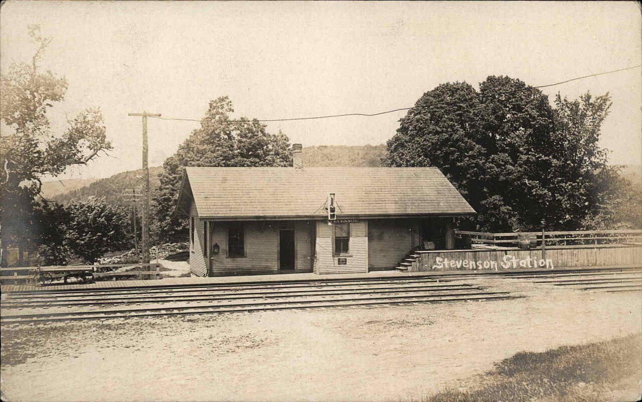
The public archives hold just one old photo of Monroe. The rest are in attics, shoeboxes and the historical society. Help start the collection.
The story
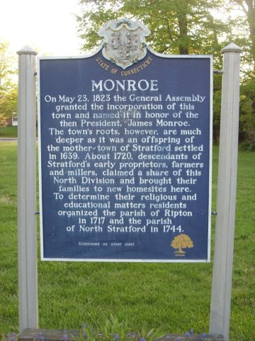
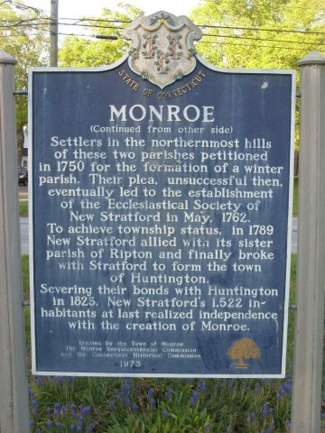
from WikipediaRead it all ↗On May 15, 1656, the Court of the Colony of Connecticut in Hartford affirmed that the town of Stratford included all of the territory 12 miles (19 km) inland from Long Island Sound, between the Housatonic River and the Fairfield town line, to include the southern portion of present-day Monroe. In 1662, Stratford selectmen Lt. Joseph Judson, Captain Joseph Hawley and John Minor secured all the written deeds of transfer from the Golden Hill Paugussett Indian Nation for this vast territory that comprises the present-day towns of Trumbull, Shelton and Monroe. In 1671, Stratford purchased from the Paugusset Indians the territory which included the remainder of the northern portions of Monroe, Trumbull and Shelton, in what is known as "The White Hills Purchase", and officially annexed it to the Township of Stratford.
Text from Wikipedia, licensed CC BY-SA 4.0.
Timeline
built from the dates on the items belowStart Monroe’s collection
The first neighbors to add old photos shape how Monroe’s history is told.
1 of 10 decades since 1900 have photos 🔁Retake an old viewStevenson station postcard, 1907–1915: stand where they stood+15 📦Share a family photoSign in to add one+10Monroe, decade by decade
1990s
Then & now
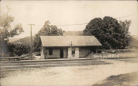
No then-and-now pairs yet. Take a photo from the same spot as Stevenson station postcard (1907–1915) and it appears here side by side.
🔁 Retake this view · +15Stories next door
nearby towns’ historyFrom Wikimedia Commons (6). Images are copied here with their credits and licenses, shown on each photo’s page. Refreshed monthly.